Wednesday, October 25, 2023

Annapurna Base Camp

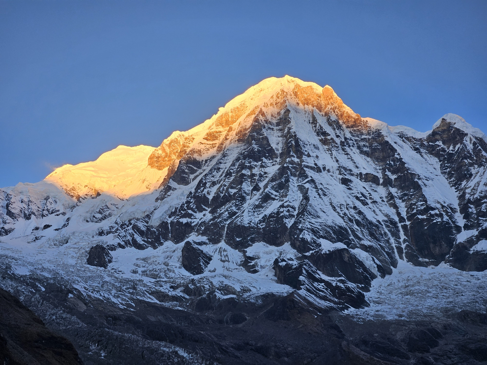
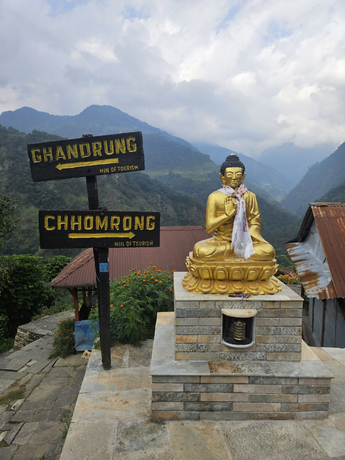
I just came back from a seven day trek in Nepal. We went up to Annapurna Base Camp, which at 13,500 feet is just the starting point for mountain climbers. But for us hikers, it was the destination. The trek was almost entirely through jungle. It was also through populated mountain communities. Each night was spent at a "guest house" sometimes called "tea house" that could be thought of as a very rustic bed and breakfast. But these Guest Houses were not some far flung outposts. They were kind of like the downtowns of small villages.

My trekking buddy claims that it was a once in a lifetime experience. Forget that! I'll be back. Maybe not until 2025 at the earliest, but I will. It would be foolish not to.

But not everyone is like me, and some folks should definitely not follow in my footsteps.

Should I trek in Nepal?

These are the questions to ask yourself. (You can answer no to any of these and still trek. But these are the things I think you must consider first if you want to have a good time trekking in Nepal.)

1 Can I do multiday?


I don't mean hiking 10 miles, camping, then hiking back. I mean doing that two or more times in a row. Because the hiking is not hard (it sure isn't easy) but there is a lot of it. There can be a week or two or even three.

I had never hiked like that, but I rode my bicycle up and down through Big Sur camping along the way, so it wasn't a big deal. My friend who has hiked Mt Whitney, and hikes more regularly, found it a challenge.

I don't think you need to hike multiday to be ready to trek. But you do need to hike. And you do need to be able to do multiday in some discipline. Who knows, maybe sailing for a week is good preparation.

2 How do I feel about stairs?

Back home we have switchbacks. In Nepal they have stairs. Some look almost like granite steps up to a museum, others are flattish stones placed in a roughly stair-like arrangement. The rise over run ratio varies widely, sometimes within a single flight of stairs. I am 5' 7" which is definitely not short in Nepal, yet some of the steps were uncomfortably tall, especially going down. 

You are not going to believe that this is the literal truth, but we climbed over a thousand vertical feet of stairs in one shot. Yes, there were a couple of landings, but it was stone steps all the way up from a river crossing to more than a thousand feet above. That was the worst one, but stairs were everywhere.

3 How do I feel about livestock?

In Nepal, you share the trail with all manner of animals. Sheep, goats, mules, ponies, buffalo, chickens. One time I passed three or four buffalo that were going up stairs quite slowly. Even if you aren't passing or being passed, you will see reminders of who went before you down the trail.

Dogs are everywhere, even laying on the highway in traffic lanes and even at ABC. Their droppings are surprisingly cleaned up. In a week, I could count the pieces of dog poop I saw on one hand, despite seeing more dogs than I have ever see anywhere in my life.

2 Can I sleep in a tent?

You won't have to. But you will be uncomfortable sleeping at some point. At the higher elevations, the window will be covered with condensation when you get up to pee at night, which you may do repeatedly. The higher you go, the less comfortable the beds.

3 Can I pack light?


Packing light is a good idea when doing any kind of traveling. When trekking, the less you pack, the less you have to lug up to 13,500'. And the less you have to repack every morning. Even if you hire a porter, you will have to pack all the crap you brought many times, and at least once in bitter cold.

I have a pretty strong DIY ethos, so I didn't use a porter. But I am also the kind of guy who never checks a bag on an airplane (not going to let them lose my bag!) I also think an eight inch square of microfiber is both a wash cloth and a towel. So your mileage may vary.

After watching countless porters pass me on the trail carrying three tourists' huge duffels tied together with rope, wearing flip flops or Chucks, I have mad respect for them. The price is quite reasonable; use a porter. And pack light.

4 Am I organized?


I am not. But I have been hiking and cycling with the same pack for years, so I have a pretty good idea what goes in the left hip pocket and what goes in the sunglasses pocket. It reduces the number of times you unpack your entire bag looking for an article of clothing you are wearing (which I actually did).

5 Am I a morning person?


It helps because you only have so long until the rain comes each day and you want to cover some ground. We ate at 6:30 each morning and tried to hit the trail by 7. We also barely ever got rained on. (Not sure if this holds true year round, but it was our experience in October.)

6 Can I eat the same food day after day?


Dal Bhat power, 24 hour. Or so the saying goes. Dal is lentil soup and Bhat is cooked rice. It is served with vegetables, chutney and a chapati. The reason you pour the dal on the bhat is that traditionally it is eaten with the fingers of the right hand. Actually, you mix the veggies and chutney in there too. 

I had dal bhat at least once a day. It was always delicious. There are plenty of other things on the menu, but they were hit and miss. I once ordered mo:mos (which are delicious and you must try) and got potstickers. Try the mo:mos in town, and eat dal bhat on the trail. Remember, you are in remote mountains and they are doing the best they can with what grows locally or can be brought up by porter.

Another reason to eat dal bhat is that unlike everything else on the menu, you get seconds. 

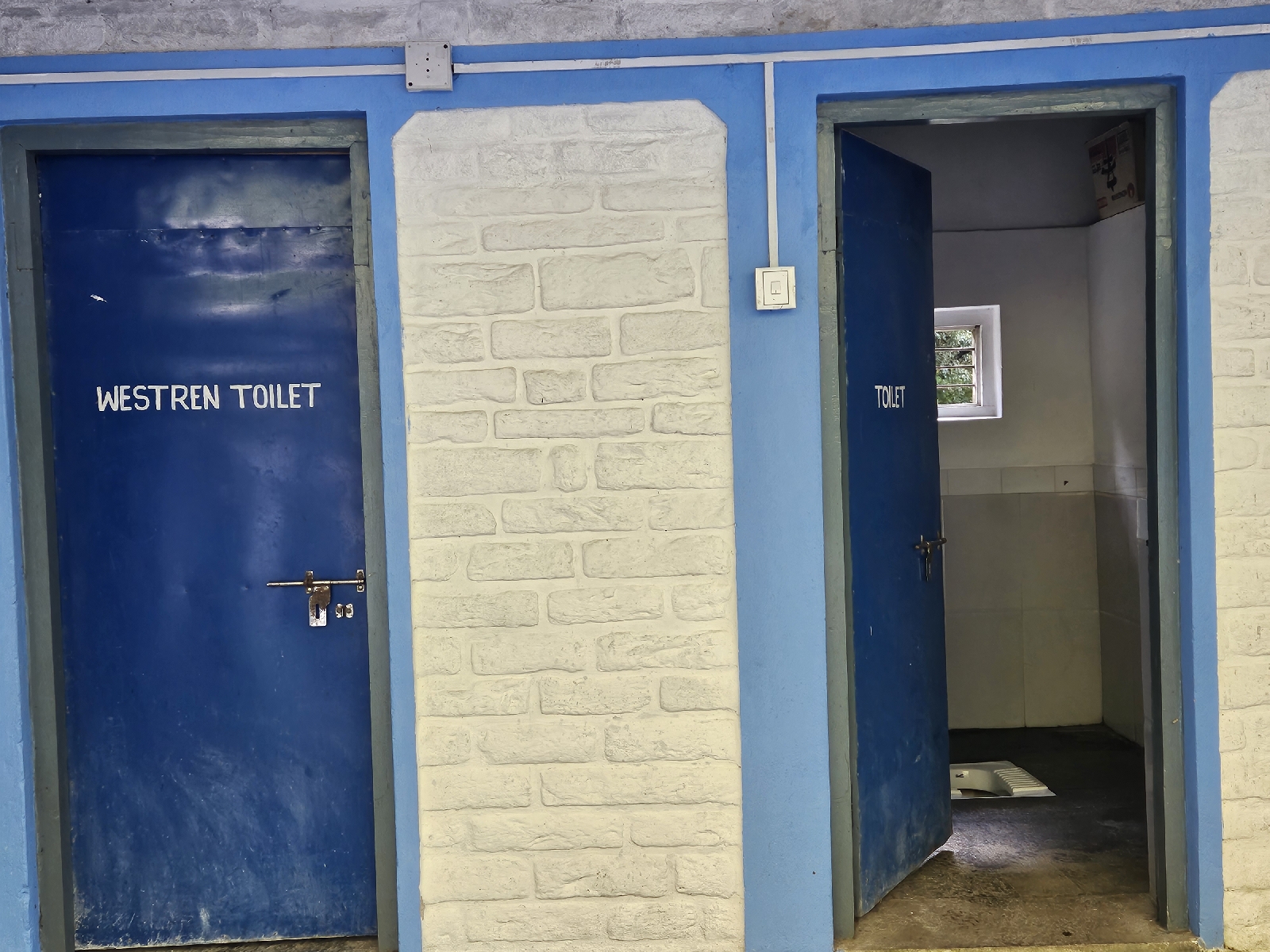
7 Can I poop in a hole?


You may never need to, but the higher the elevation, the lower the western/traditional toilet ratio is. A traditional toilet is much like a traditional Japanese toilet, a porcelain hole in the ground that you squat over. Unlike the ones in Japan that flush, a traditional toilet in Nepal requires that you pour some water  from a bucket to conclude your business. The upside is that there is often a bidet hose next to the toilet.

What else is there to do in Nepal?

Our journey started and ended in Kathmandu, the capital, and the only city with a truly international airport. Since we had to be there, we checked out a few tourist attractions including Swoyambhu Mahachaitya, the Monkey Temple.

Buddha Stupa is a redundant and generic name, but that's what it says on Google Maps. The brochure we got when we paid the admission called it Boudhanath Stupa. It's said to be the largest Stupa in the world.


We also went to Durbar Square which is of mostly historical interest. I'm glad we went, but not sure if I would recommend it. Depends on what you are looking for. I mostly wanted to get out of Kathmandu, as our trek was based out of Pokhara.


Lake Phewa in Pokhara gives the name Lakeside to the tourist district. It also has row boats you can rent, with or without someone to row for you. We went for a row before the trek.

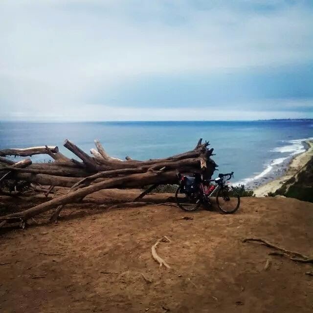
After the trek, I rode a mountain bike up to the World Peace Pagoda. As a cyclist, that was an effective way to clear the lactate from my legs. The mountain bike rental was 900 rupees, or $6.79, for the whole day.

Final thoughts

I would encourage anyone who wants to trek to do so. Nepal was a very safe country from what I saw. The service there is incredible. The prices would be incredible if you could somehow forget how much the plane ticket cost.

If you do, safe travels! If you don't, I hope you find a place even better suited to you, and enjoy the heck out of it!

Wednesday, October 1, 2014

Big miles in Big Sur


What does it like like when I go on vacation? A little bit like this:

A city park. And a bikepacker's bike.

So what is riding through Big Sur like? Kind of like this picture suggests:

Looks like we are on the scenic route!

And, even though this is significantly south of anything you could call Big Sur, it was like this, too. In that there were fog and clouds, and it was basically riding on a highway...


After 4 days of riding, we hadn't had enough, so we continued south to Santa Barbara. Which is much less wild, but scenic nonetheless. The very first picture of this post is in a park in Santa Barbara, too, but I feel like this picture captures the feel of the town a little better:

So-Cal style beach.

Of course, it takes some calories to get from San Luis Obispo to Santa Barbara. So we spent some time in this joint before heading out:

Organic coffee and everything!

And even though it was only two days out of five, the hundred mile stretch from San Simeon to Carmel was what my vacation was about. I say two days because we rode it south to north one day, then north to south the next.

yep.

I'm not a big fan of Lompoc, but apparently Lompoc is a big fan of me. Look at the sign they erected for my arrival:

The trip was not all wilderness and camping. There was a train, a train station, and downtown Los Angeles involved...


Some of the ride felt like this:

Long miles

And some of it felt like this:


There was camping and campgrounds and stretches of night:


And Thai food and cows and a guy with a skateboard who thought my load was too light:

San Luis Obispo and Moro Bay

Mannuel's phone ate all his pictures, so these Instagram collages are all that he has left:


This is the bike Mannuel brought:


And even though it was my ride, I can still say, "Wish I was there!"

Wednesday, February 5, 2014

Bike Be All Crazy

My ride yesterday took me up the SGRT, which is nothing new. What I saw, however, was new. At least new to my eyeballs.


As I approached this contraption, it appeared to be one large vehicle. But as I passed, I saw that the rear half was just pushing the front half along. Notice the special bumper:


Of course, when I stopped to take pictures, they separated and were all, "I wasn't doing that!"

Tuesday, July 23, 2013

Pacific Coast Bicentennial Bike Route

My bike wants to get on a train.

So I had a long weekend, the weather was hot, and it may have just been in my head, but I could swear I smelled smoke from the fire in Idyllwild. Not wanting to stay in town for any of that noise, I headed to Union Station to catch a train into Ventura with my bike for a ride up the coast.

She's got a ticket to ride...

...and a destination.

Back in 1975, a bicycle route was established that basically follows Highway 1 down the California coast with some detours for reasons of safety, legality, or scenery. I say "down" because south is the preferred direction of travel. Even without the tailwind, the views are better from the "cliffside of the trail." Though CalTrans stopped publishing maps for the route in 1982, the Adventure Cycling Association distributes a variant of the route, and perhaps others do too. Thus, summertime brings lots of bike tourists to the route I was following. Many of the "pannier crowd" are international tourists spending as many hours sightseeing and dining as riding. Domestic bikepackers seem to be a thriftier crowd. Many of them are on thousand mile (or more) journeys, doing the entire route, or doing their own route on a door-to-door loop. But no matter who you are, the $5 hiker/biker campsites at world class destinations like Morro Bay State Park are attractive. The warm shower alone is worth the price of admission.

You can't see Morro Rock because the fog won't lift for a while. Wait for a photo op? Ain't nobody got time for that!
One of the nice things about staying at a campground is that you get to talk to some of your peers. Talk naturally turns to routes, destinations, and gear. I was given directions to the grocery store and a recommendation of the best place for fish and chips. As I was starting to get cold, I opted for hot food. The best place was closed, so I went to the one next door. When I ordered fish and chips, they asked me if I wanted chips or fries!

You know that palm tree island with the long bridge, don't you?

But I'm making it sound like I went to Morro Bay. Nothing could be further from the truth. I went for a RIDE. I didn't know if I would make it that far. And going further was an option, too, if I wanted to get on a train in San Luis Obispo on the way back. One of the nice things about riding the coast is that the cell phone always seems to have reception. I was able to give updates of my progress (and my evolving plans) every place I stopped. Some other riders don't bring phones, relying instead on the internet at public libraries for email communication. I couldn't do that. I gots to have my Words With Friends while I'm waiting for that cheeseburger...

Nothing's showing.

And the Pacific Coast route doesn't just hug the coast, either. There is quite a lot of variety. Ranch land, farm land smelling of ripe strawberries, small towns, mossy trees, lone oaks dotting the grassy hillsides. My favorite views were the ones that simply couldn't be captured in a photograph.

Share the road.

I had never been to UCSB before, but I got the opportunity, as the route crosses the campus. Talk about a bike-friendly school! There were many, many bicycle parking lots scattered about. Some of them were huge! And bike paths criss-cross the campus. I don't think my picture does it justice, but here you go.

I've got to go back and see this school in the daylight...

Everybody loves a sunset.

On my last day, I called ahead to the SAG vehicle. Not to cut my ride short (I've done that before), but to extend it. "Hey, Babe. I don't want to get on the train in Ventura. If I ride down to Malibu, can you come pick me up?"

I am in the habit of waving to other cyclists going the opposite direction. On the 605 bike path, lots of people wave back. If you have ever ridden Ballona Creek, you know how some cyclists are too serious to be friendly. I was expecting the "west-side cold shoulder" in Malibu, but even the guys with aero-bars gave me a nod. That was a nice surprise.


Monday, April 1, 2013

I Took A Picture!

     It seems like my infrequent posts consist mostly of apologies for the lack of pictures on my posts. It's becoming increasingly clear that there are two schools of thought in this uber-digital age:
  • Pictures, or it didn't happen.
  • This is such a wonderful experience that I don't want to stop experiencing it in order to "document" it.
Today's case in point is yesterday's bike ride. I left at 9:30am and did not arrive at my destination until 8:00pm. Most of those hours had ample lighting for photography and/or experience. From 10:30am until 6:30pm, I was out of my cell service area. So no checking my Facebook, no texting my friends, nothing much to keep me from taking pictures. And yet, here it is. My one photo stop:

North side of the road
South side of the road
     I don't have much to show for my ride. Some tan cheeks, knees and neck... A picture that only counts as two because the panarama mode only holds so much. But I have one story. 
     My photo stop (which was really a stop to adjust something on my bike, or adjust my clothing, I forget...) was about 6 or 7 miles beyond the turnoff to Crystal Lake. Earlier, as I was standing on the pedals, climbing and panting, some dude descending shouted out that I was "...Almost there!" Kinda strange when you consider I was about a third of the way into my ride. If he had known my destination, would he have shouted "Only 60 more miles to go..."?
     Oh, the silly little things that make me laugh!